This blog post contains a direct comparison of outdoor leisure maps for walking, cycling and other activities.
Ordnance Survey
The Ordnance Survey (OS) was formed in 1791 and has been producing maps for over two centuries. They are ubiquitous in the UK, producing several ranges of maps for a variety of purposes
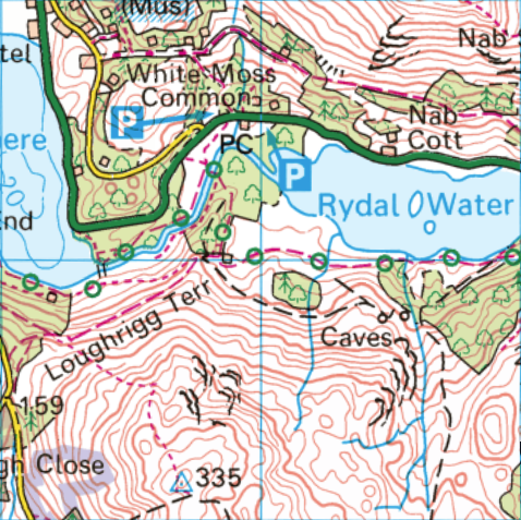
OS Landranger 1:50,000
The most common and well established range is the OS Landranger series. You will find it in printed form with a pink cover at a scale of 1:50,000 (2cm on the map is 1km on the ground). A total of 204 titles cover the whole of the UK.
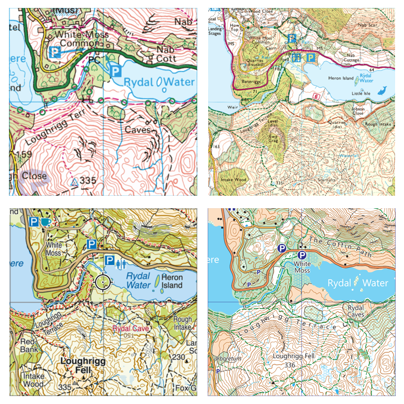
See the example below – Landranger maps have their uses, but are not optimised for outdoor activities like walking and cycling. The small scale means there is insufficient detail on the fells. Only public rights of way are marked as opposed to actual paths on the ground.
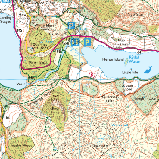
OS Explorer 1:25,000
Popular for outdoor leisure activities, you can find the OS Explorer series with its orange cover at 1:25,000 scale. Originally just covering selected national parks, it now covers the whole of the country with a total of 403 titles.
The Explorer maps are a step forward for outdoor activities. They show plenty of detail in the contours, rocks, paths on the ground, tree cover, and tourist features. However, as can be seen below, on detailed open fell areas it can be hard to get a good picture. The vague grey rock detail often obscures the contours, and the yellow wash for open access land makes the brown contours harder to interpret.
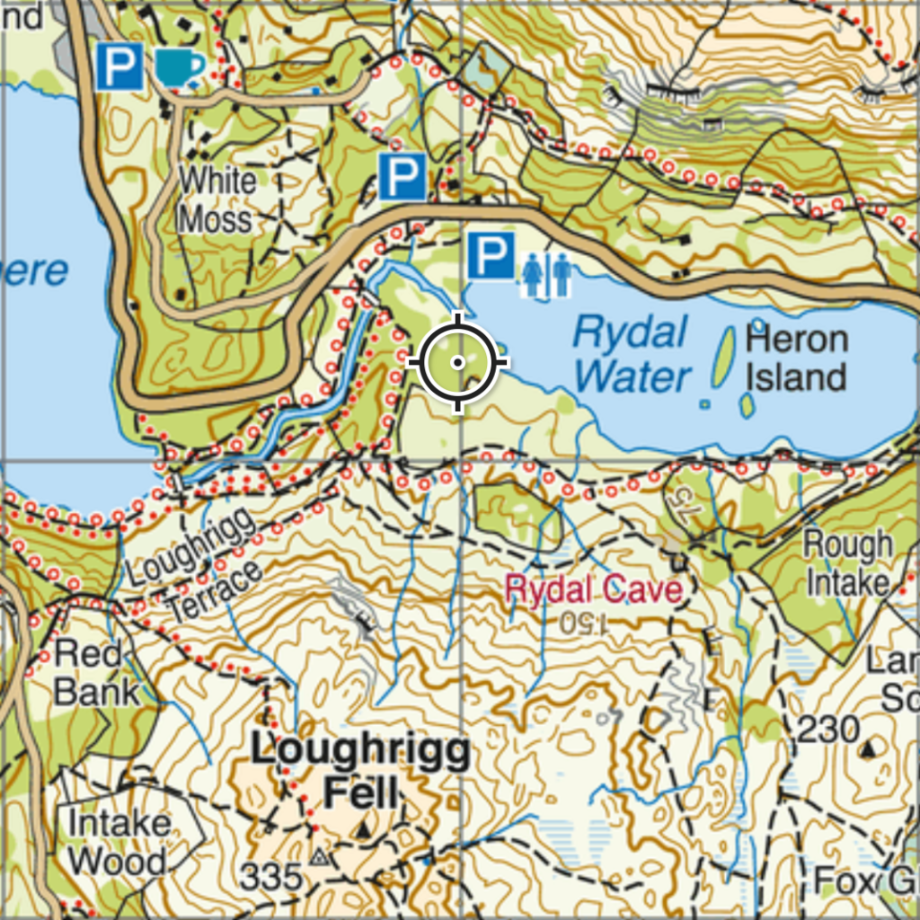
BMC / Harvey Maps
Harvey Maps was formed in the late 1970s, focussing on high quality mapping for outdoor activity. The clarity of mapping is evident comparing the sample below with the OS Explorer 1:25,000 sample above. The contours are much clearer, with innovative grey contours for rocky ground, and key features standout better. Harvey maps have many titles across the UK, with printed publications mainly available at 1:40,000 and 1:25,000 scales.
In the early 2000’s, Harvey maps partnered with the British Mountaineering Council (BMC) to produce the British Mountain Map. Printed at 1:40,000 scale. These use the same underlying mapping as Harvey maps, but with some differences. For example hill shading and highlighting of rock climbing crags.
Laser Mountain Maps
Harvey maps represented a step forward in outdoor leisure mapping compared to the Ordnance Survey. However they have remained largely unchanged for the last decade. Meanwhile there is demand for quality and accuracy has increased. At the same time new sports, interests and tourist demands have sprung up.
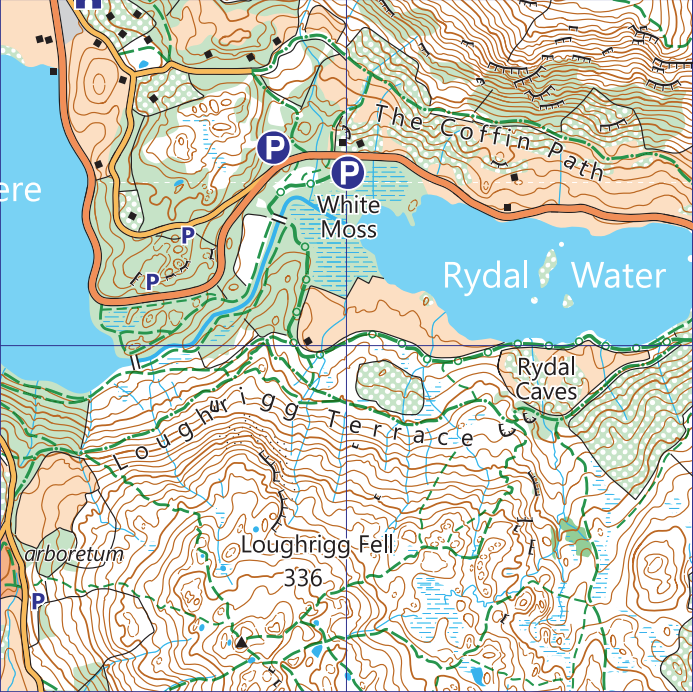
This is where Laser Mountain Maps come in. First published in 2024 they represent the very latest in outdoor recreation mapping. Using openly available LiDAR laser mapping techniques, and our decades of experience drawing maps, they combine accuracy with readability. Free from clutter and with a clear symbol set.
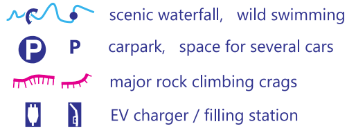
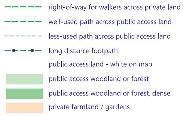
The maps reflects the latest interests of today’s outdoor adventurer. This includes wild swimming spots, scenic waterfalls, small car parking spaces, rock climbing crags, and EV charging points. They focus on highlighting the paths you’ll find on the ground, big or small. From gravel biking tracks, bridleways needing a mountain bike, obvious footpaths, and the less travelled trods. You can read more about the novel mapping features in Laser Mountain Map features.
Find out about all our titles at Lake District maps. Check out the Free Grasmere map to get you started. All the maps are available on the Avenza Maps app – see Using Avenza Maps.