We are excited to announce our free sample map of Grasmere is now available from Laser Mountain Maps via the Avenza Map Store. The map covers the village of Grasmere, the adjacent lake, and the nearby Silver How. Download it now to plan your next adventure!
What is covered by the FREE Grasmere map?
The map allows you to:
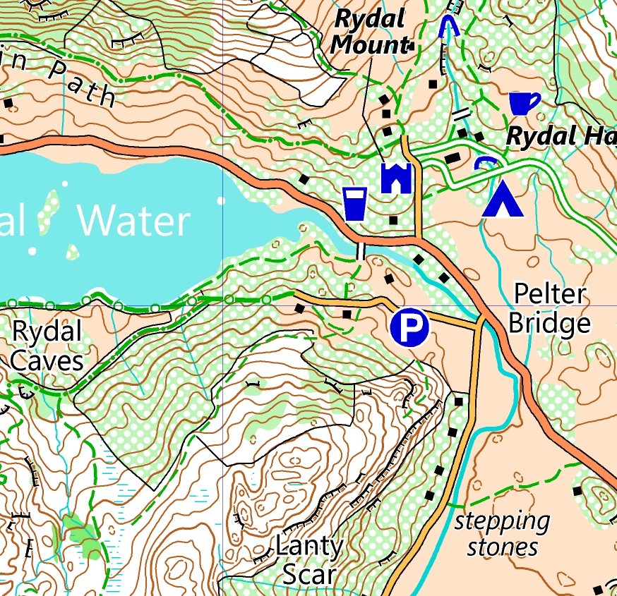
- Explore Grasmere village, famous for its gingerbrad.
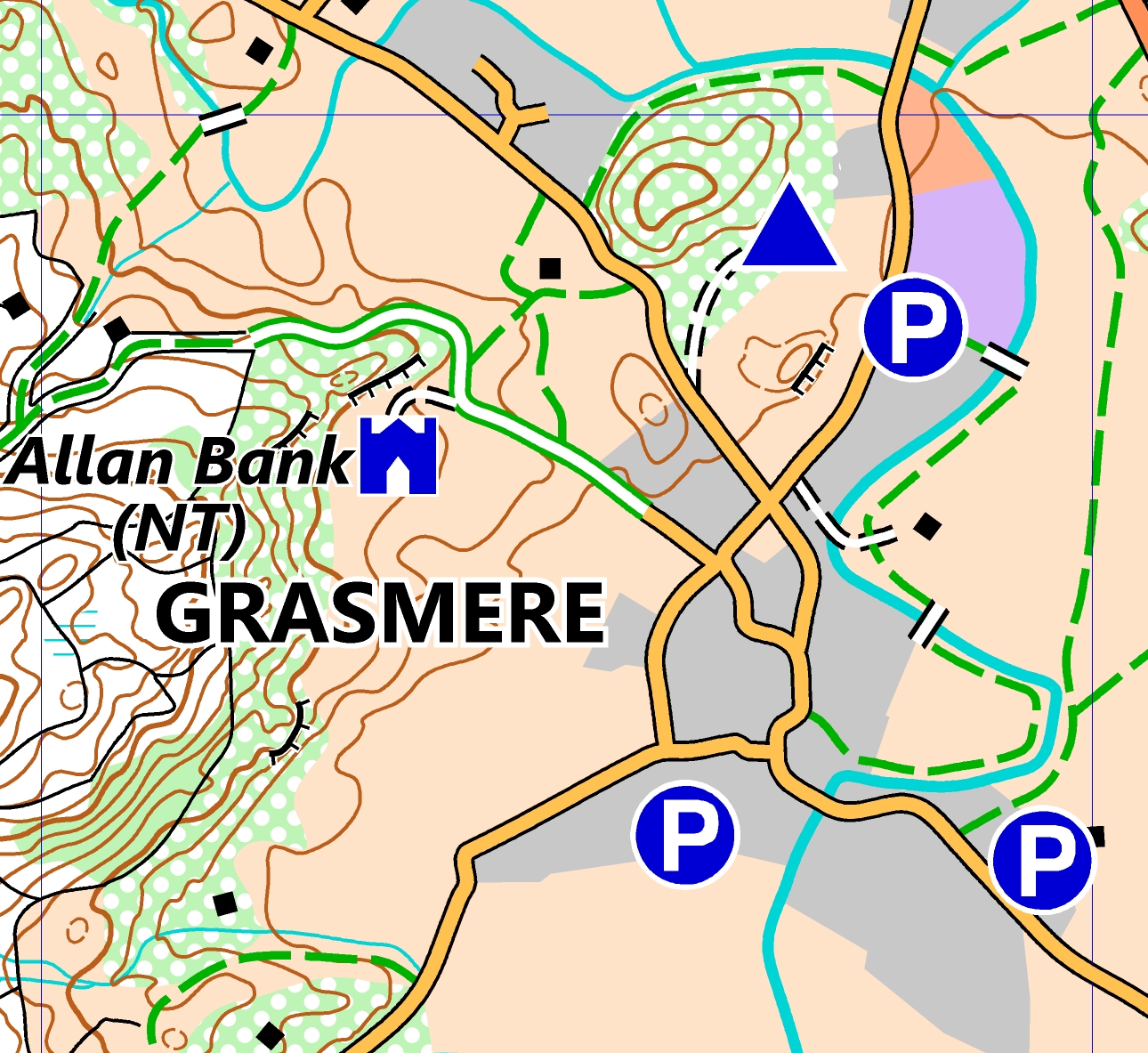
- Visit location attractions including Dove Cottage (where poet William Wordsworth lived) and Allan Bank (National Trust property).
- Take a walk around the beautiful Grasmere water.
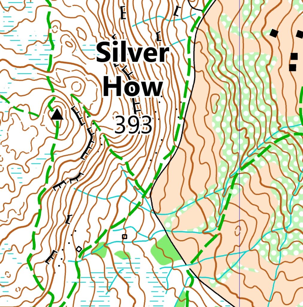
- Climb the nearby Wainwright top of Silver How (393m) with amazing views of the area.
What is Laser Mountain Maps?
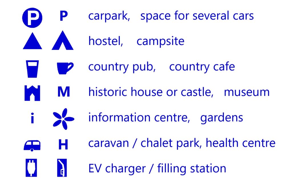
We are the next generation of ultra clear leisure maps in the Lake District. They are created by our expert team with decades of experience creating maps in the Lakes and beyond. For more information see our introductory blog post Laser Mountain Maps is live! The maps contain all the usual information you’d expect, plus new symbols for activities like wild swimming spots and gravel biking trails. Future blog posts will help you understand some of the key differences between Laser Mountain Maps and other products.
How to get the free map?
See our guide to Using Avenza Maps for an overview of the app and how to get it. Get the FREE Grasmere map via this link, or the button above, which take you to the app (or the website on your PC). Alternatively, search by location for “Grasmere” or filter for maps published by “Laser Mountain Maps”.
Want to get more maps?
We have already published our first paid for map of Ambleside and surrounding fells. Stay tuned for publishing more maps in the coming weeks, in time for your summer holiday adventures in the Lake District! Follow us on Facebook to hear about the latest updates.
Planning a special event like a trail race or charity walk? We also offer Custom maps for your event – get in touch to find out more.