Our original and first published title covering Ambleside and the surrounding fells. Includes the Fairfield Horseshoe and the towns of Ambleside, Grasmere and Elterwater.
27 Wainwrights including Fairfield, Red Screes, Loughrigg Fell, Helm Crag and Baystones (see full list of Wainwrights below).
Also features Windermere, Rydal Hall, Easedale Tarn, Kirkstone Pass, Wray Castle and Dove Cottage.
Click here to get it now or read on for the adventures that lie in store!
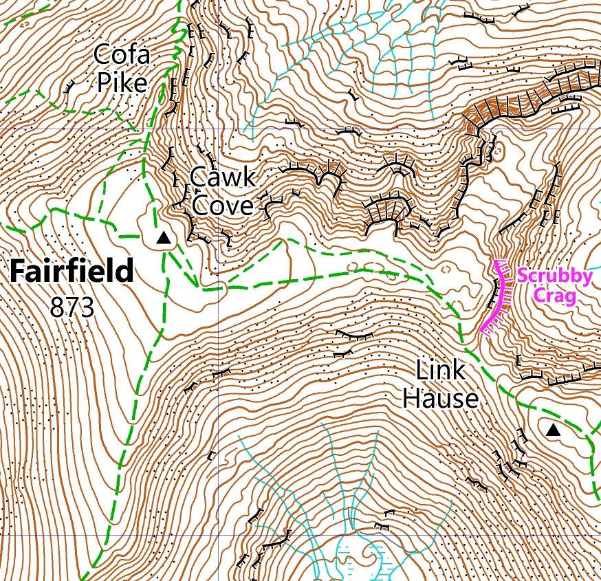
Walk or run the Fairfield Horseshoe
The iconic horseshoe of fells, visible from the natural starting point of Ambleside. Walk it or run it, clockwise or anti-clockwise, the choice is yours. At 13 miles it typically takes around 6-8 hours walking. Halfway round is Fairfield the highest point at 873m, with several other minor summits traversed along the way.
There are fantastic views south down Windermere, north towards the Hellvelyn Range, west towards the Langdale Pikes and central fells, and east towards High Street, with Ullswater visible to the north east.
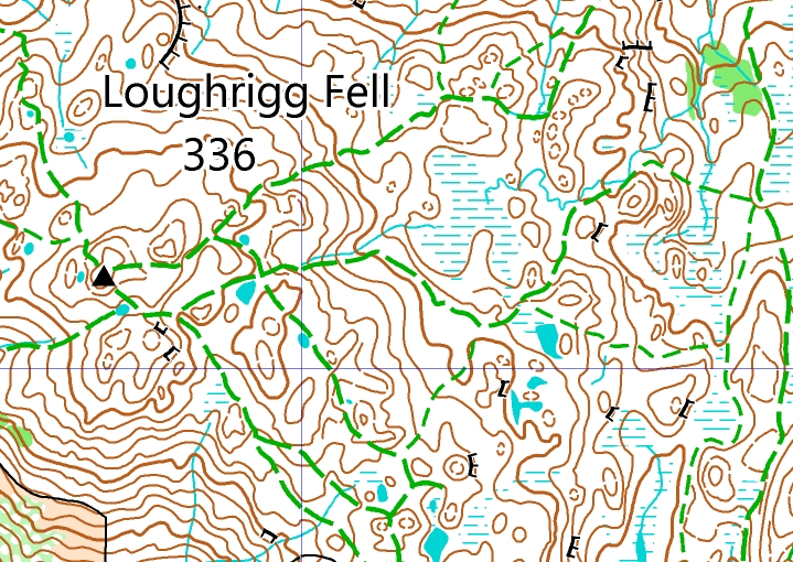
Admire the views from Loughrigg Fell
A favourite Wainwright, easily accessible from Ambleside. A good track winds steadily up from Rothay Park onto the fells. Once on the fell a series of bumps and tarns soon leads you to the summit. There the views extend in all directions, revealing the waters of Windermere, Grasmere and Rydal Water, and a panorama of surrounding fells.
Either return the way you came, or make a circuit, taking in the Loughrigg Terrace and the picturesque Rydal Caves on the way back.
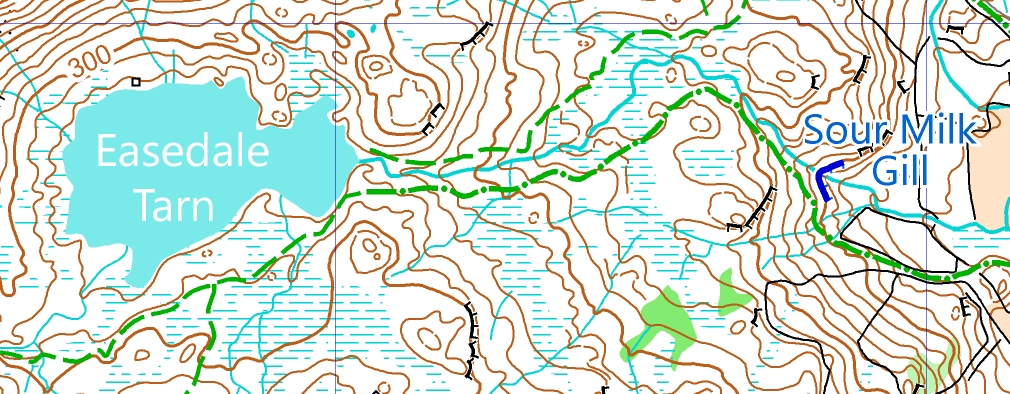
Take a dip in Easedale Tarn
Easedale Tarn is within easy striking distance of Grasmere village. After a mile of good path you see the attractive Sour Milk Gill with its gushing waterfalls. Keep going, crest the hill, and you arrive at Easedale Tarn. Pack your swimming costume – this is a lovely spot for a dip in the refreshing waters.
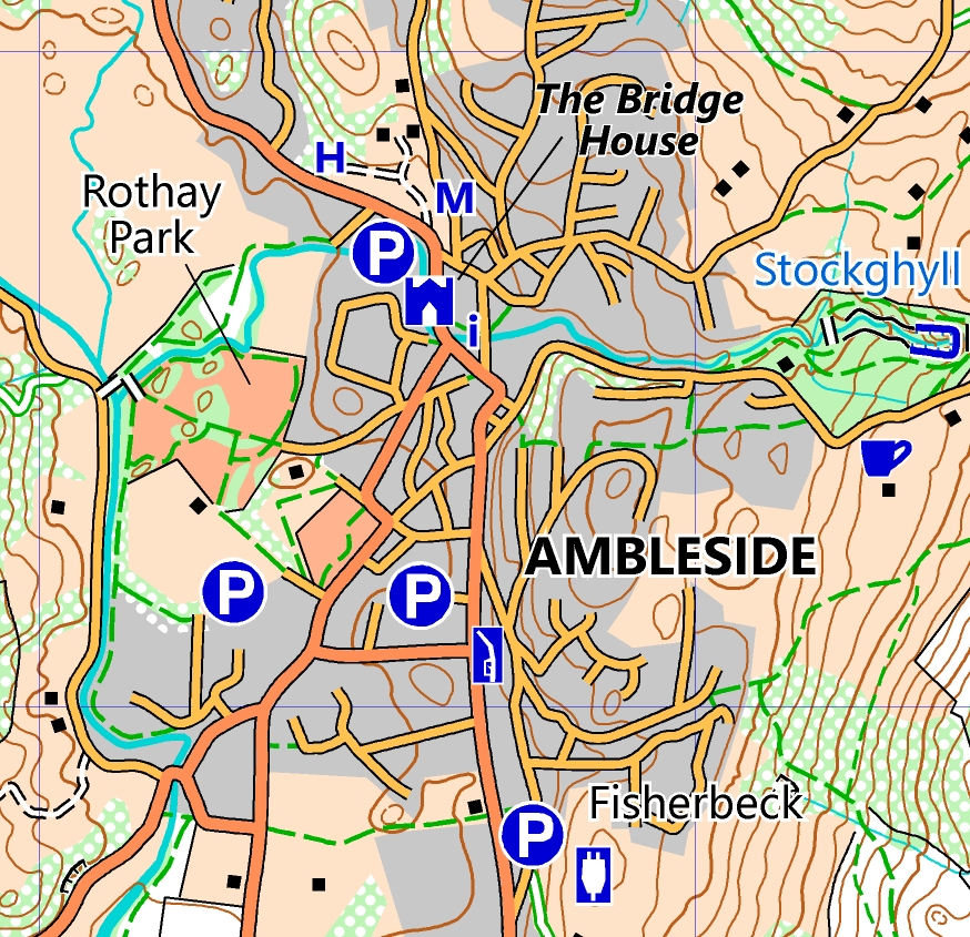
Explore Ambleside
The town of Ambleside sits right at the heart of the Lake District. It offers many outdoor shops, cafes, restaurants and accommodation. An ideal base for a holiday or weekend getaway for your next adventure!
Get the map now!
For all these adventures, and much more, Laser Mountain Maps has you covered. Ambleside and the surrounding fells is available exclusively for digital download in the Avenza Maps app. Use this link or hit the button below. See our blog post for more information about Using Avenza Maps.
Full list of Wainwrights
A total of 27 Wainwrights covered by this map.
- Baystones
- Black Fell
- Blea Rigg
- Calf Crag
- Dove Crag
- Fairfield
- Gibson Knott
- Great Rigg
- Hart Crag
- Hartsop above How
- Helm Crag
- Heron Pike
- High Hartsop Dodd
- High Pike
- Holme Fell
- Lingmoor Fell
- Little Hart Crag
- Loughrigg Fell
- Low Pike
- Middle Dodd
- Nab Scar
- Red Screes
- Seat Sandal
- Silver How
- Steel Fell
- Stone Arthur
- Tarn Crag