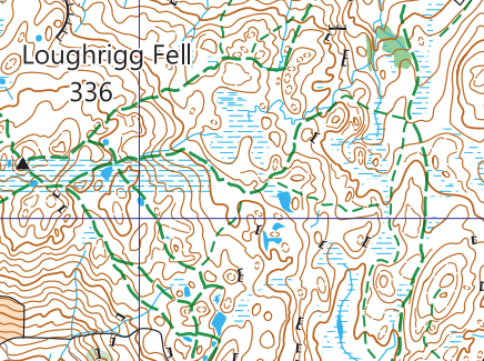
If you’ve ventured into the hills you are most likely familiar with Ordnance Survey mapping and may have also come across Harvey Maps. However, it is time for a new generation of ultra clear leisure maps for your outdoor adventures. This article introduces you to some innovative new Laser Mountain Map features, and what sets them apart from other maps.
New Map Symbols
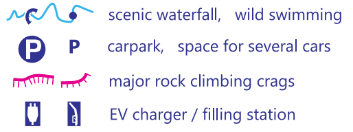
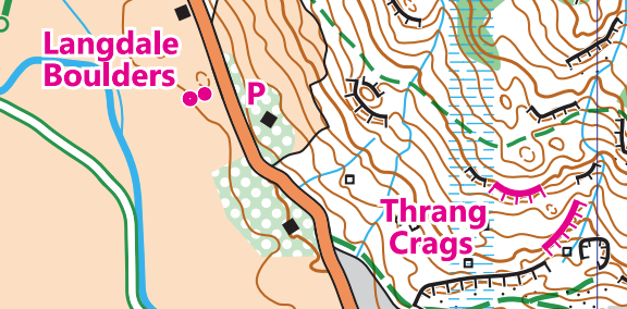
Laser Mountain Map features include various symbols not seen on any other leisure maps on the market today:
- Searching for that beautiful photo? Zoom in on a scenic waterfall.
- Fancy a dip? Seek out a wild swimming spot.
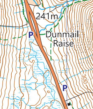
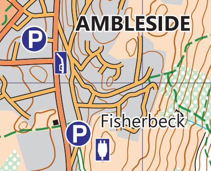
- Looking for an elusive parking spot for a walk? Identify where there is space for several cars away from the larger tourist traps.
- Hitting the rock? Match your guidebook to major rock climbing crags.
- Running out of juice? Plug in to the nearest EV charger.

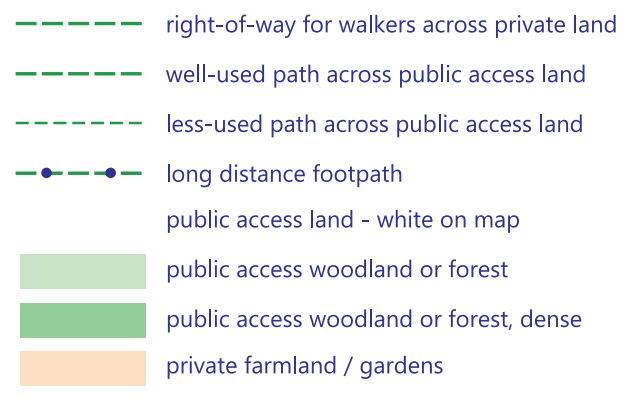
Paths, rights of way, and open access land
A brief history lesson… For as long as we have been able to walk there have been paths through the countryside. People move around as part of daily life. Through the 18th and 19th centuries, established paths changed as farming and enclosures carved up the land. Then lobbying in the early 20th century led to the National Parks and Access to the Countryside Act 1949. This created, together with national parks, a definitive map of public rights of way. Things further changed with the Countryside and Rights of Way Act 2000 (CROW) which designated large tracts of upland in England and Wales as “open access” with the “right to roam”.
This has led to confusion in existing maps covering upland areas. Some public “right of way” they depict have no discernible path on the ground (indeed it might be deep heather, wet bog, or thick forest). Other times there is a clearly frequented path on the ground, with legal passage under the CROW act, but it is not a public right of way and not as clearly indicated on the map.
At Laser Mountain Maps we believe in helping you make the most of your adventures in the hills. That is why we don’t show rights of way on open access land, because you have a right of passage on foot across all that land. We just show the actual paths on the ground. Moreover, we distinguish well-used and less-used paths.
Public access land – the most common terrain you’ll encounter in the hills – is also just white to reduce the colour on the map and make it clearer.
Of course we do show the public rights of way through private land where it is important that you stick to them.
Different grades of bridleway
Ever had that sinking feeling when you gravel bike gets bogged down in the mud? Or conversely your want something more challenging on your mountain bike? Well Laser Mountain Maps are here to help, distinguishing between:
- surfaced vehicle tracks – fine for hybrid bikes
- smooth trails – suitable for gravel bikes
- rougher bridleways – best left for mountain bikes.

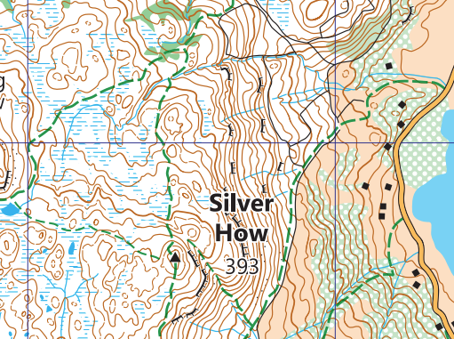
Landform mapping with LIDAR
LiDAR or “Light detection and ranging” has revolutionised map production. Airplanes fly across the terrain, bouncing laser signals off the ground. The signal return is then used to determine many things including elevation, vegetation type, and even pick out features like paths and rocks. This allows for a super accurate representation of landforms on maps.
However, there is still a skill to drawing ultra clear maps using this technology. Maps have a “contour interval” and contours in theory join all points of the same height (from example 250m, 260m, 270m, etc.). But a map strictly adhering to those rules may miss significant features which are less than the 10m interval (and a 9m hill is quite big!). Conversely they may over-exaggerate small features (a 1m hill that just goes over a 10m interval).
At Laser Mountain Maps we “nudge” the contours up or down slightly, to give you the most realistic representation of what you actually see on the ground.
What to see more Laser Mountain Map features?
To see all these features and more, check out our introductory blog post. It advertises our first published map – Ambleside and surrounding fells – from which all the snippets in this blog are from. Or download the free Grasmere map and go for an adventure using Avenza Maps. Happy exploring!